GeoReferencing
Number of coordinate systems
Number of different coord systems displayed simultaneously
Methof/software for adding coordinates
Free Reader plug-in
Accuracy of georeferencing
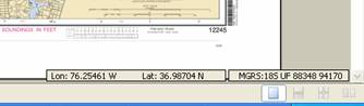
GeoReferencing Example 1 – Shows a single panel nautical chart with georeferencing. The georeferencing software use permits the use of xx different projections, and the calculation and display of locations in yy coordinate systems simultaneously.
GeoReferencing Example 2 – Shows a nautical chart with 3 insets. Both the main panel and the insets are independently georeferenced.
2 samples, one with inset and one with main panel